|
Gunamoi Software
|
|
HorizonProfile Program |
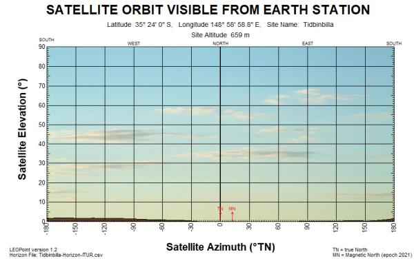
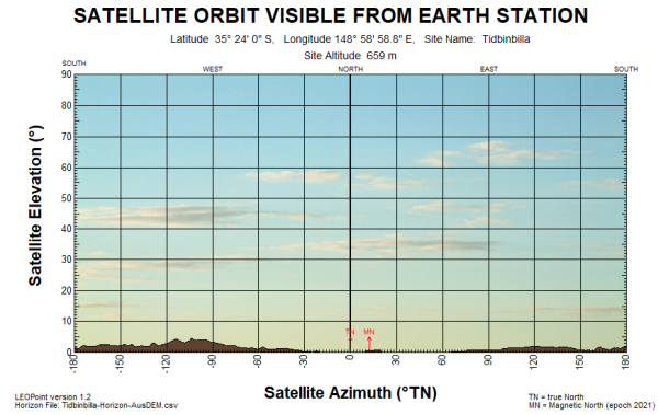
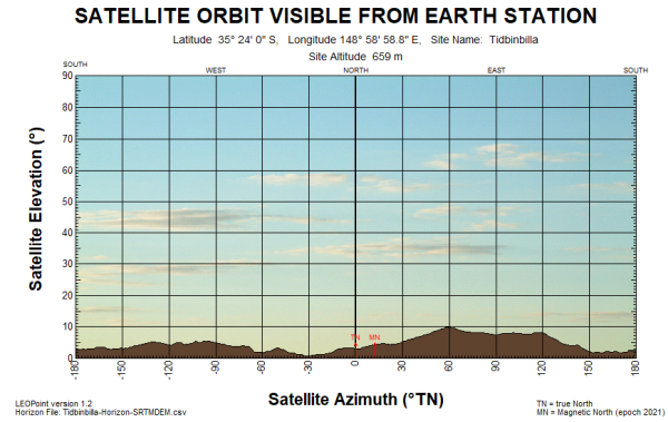
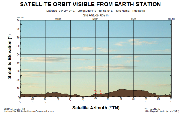
Examples of data produced by HorizonProfileHorizonProfile was used with different DEM selections to produce horizon profile CSV files and horizon peaks kml files for the NASA DSN site at Tidbinbilla. Our program LEOPoint was used to plot an image of the resulting horizon profiles. Our program MapList-Flat was used to plot a satellite map image of the site with horizon peaks marked in red. It can be seen that neither the ITUR DEM, nor the AUSDEM database, have sufficient resolution for accurate horizon profiles. However the SRTM DEM option with 3 second resolution gets very close to the accuracy of local contour data. ITUR DEM Horizon Profile (5 minute grid resolution)
AUSDEM Horizon Profile (9 minute grid resolution)
NASA SRTM HGT DEM Horizon Profile (3 second grid resolution)
Horizon Profile produced using detailed KML Contour file from QGIS.
|